
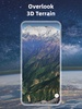


Earth 3D Map delivers a comprehensive virtual exploration experience, allowing you to view any location on Earth through high-definition satellite imagery. The app provides a 3D representation of terrain features, including forests, lakes, buildings, rivers, and roads with exceptional detail. It allows you to effortlessly explore destinations and landmarks worldwide without leaving your device, making it a valuable tool for immersive virtual travel and geographical study.
Advanced Features for Precision and Versatility
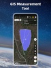
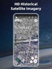
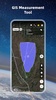
Designed for enhanced accuracy and usability, Earth 3D Map integrates detailed satellite and world maps, offering a range of functionalities like a compass tool, historical street views, and distance or area measurement. It supports a variety of file formats such as KML, GPX, CAD, SHP, and GeoJSON to help you efficiently manage your GIS project files. The inclusion of UTM and MGRS coordinates further enhances its capability, catering to both casual users and professionals who require precise mapping solutions.
Global Coverage and Accessibility
Earth 3D Map provides access to an extensive selection of countries and regions across continents, ensuring global availability. Whether exploring metropolitan areas or remote locations, you can delve into diverse terrains with the app’s latest satellite imagery. Its versatility makes it ideal for educational purposes, travel planning, or professional geographic analysis.
With its range of innovative features and extensive geographic coverage, Earth 3D Map becomes a superior tool for both practical navigation and global exploration, accessible directly from your Android device.
Requirements (Latest version)
- Android 7.0 or higher required
Comments
I love this app